• Skip to primary navigation
  • Skip to main content
  • Skip to primary sidebar

Friends of the Fox

  • Home
  • News
    • Newsletters
    • Previous News
  • Join
  • About
    • Overview
    • History
    • Education Materials
    • Committees / Minutes
    • Board of Directors
  • Projects
    • Appleton Trestle Trail
    • Little Chute Windmill
    • Rapid Croche Boat Transfer
    • Heritage Parkway
    • Water Trail Portage
  • Volunteer
  • Explore
    • Clean Up the Fox
    • Geography
  • Navigate
    • Boating
    • Donate To Unlock
    • Recreational
    • Lock / Bridge Schedules
    • Locks Construction Timeline
    • Paddle Info
    • Lighthouse Tour
    • Charts / Maps
    • Public Access
    • Weather / Water Conditions
  • Events
  • Contact
    • Contact Form

Public Access

Friends of the Fox realizes that without information about Public Access to the Fox River a boater is lost looking for ways to access the information you may need to plan a day of fun on the water. We have compiled some useful maps and tools to make your boating experience more of a pleasure.

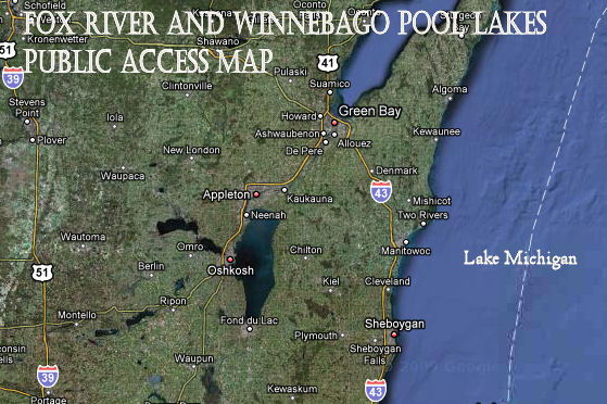
The above map will give you information on:

  • Boat Access
  • Carry-In Access
  • Locks
  • Lighthouses
  • NOAA Hydrology Gauges
  • Dams (*Dams: Disclaimer – Dam information should not be used for navigation! Failure to consult an official source of dam locations can result in loss of life and/or injury.)

NE WI Paddlers Association Google Map–NE Wisconsin Paddle launch locations

(The above map was created for use by the Wisconsin Paddlers.)

  • More information regarding the NE Wisconsin Paddlers.
  • DNR Listing of Public Access Points

For suggestions to add or change any sites on the Friends of the Fox map please contact us.

sidebar

sidebar-alt

Log in
© 2023 Friends of the Fox.
All rights reserved.